No Content Set
Exception:
Website.Models.ViewModels.Components.General.Banners.BannerComponentVm
Services
Technical services and consulting solutions for clients in the property, energy, transport, water, resources, defence and government sectors.
Advisory and management consulting
Communications, creative and digital
Design and development
Environment
Exploration and development
Health, safety and risk
Laboratories
Oceans and coastal
Planning and approvals
Project and program management
Training
Water services
Advisory and management consulting
RPS advisory and management consulting services for businesses and projects, including economics, due diligence, transaction advisory, ESG and more.
Communications, creative and digital
Communications, creative and digital solutions for governments and businesses including community engagement, design, research, data and software development.
Design and development
Technical and consulting services for buildings, infrastructure and cities including architecture, engineering, surveying, landscape architecture and urban design.
Environment
Environmental consulting solutions for responsible, resilient and sustainable development including impact assessment, ecology and contamination management.
Exploration and development
Technical services for energy projects including seismic operations, drilling and wellsite geology, reservoir management, independent reporting and more.
Health, safety and risk
From safety case development to emergency response strategy, discover services and expertise to reduce your risk profile and keep people safe.
Laboratories
Scientific analysis services for AgroScience, food safety, workplace exposure, environmental analysis and contaminants of concern in Europe and the UK.
Oceans and coastal
RPS technical solutions for marine infrastructure and offshore development including coastal engineering, marine biology metocean science, and emergency response.
Planning and approvals
Development strategy, planning and approval solutions for buildings, infrastructure, transport and city projects and investments.
Project and program management
Project management solutions for the most complex building, infrastructure, organisational change, and systems projects.
Training
Specialist training services, programs and accreditation for health, safety and risk, project management, and energy sector capability development.
Water services
Solutions for the water sector including quality monitoring, modelling, infrastructure design, engineering and asset management.
Sectors
World-leading technical and consulting solutions for clients in the property, energy, transport, resources, water, defence and government sectors.
Property
Energy
Transport
Defence and government services
Water
Resources
Property
Design, technical and advisory services for the property sector, including residential, commercial, retail, industrial, health, education and data centre projects.
Energy
Energy exploration, development and optimisation solutions for renewables, power and gas networks, energy storage, oil and gas and nuclear facilties.
Transport
Smart, safe and sustainable transport infrastructure development services and advice for rail, aviation, port and road clients and projects.
Defence and government services
Expertise for defence capability and infrastructure investments, security and safety projects, and information and telecommunications initatives.
Water
Discover our industry-leading strategy, design and management solutions for wastewater, groundwater, flooding, drainage and network infrastructure.
Resources
Commercial data, design advice and technical management solutions for safe and environmentally responsible resource exploration and operations.
Technical services and consulting solutions for clients in the property, energy, transport, water, resources, defence and government sectors.
Advisory and management consulting
Communications, creative and digital
RPS advisory and management consulting services for businesses and projects, including economics, due diligence, transaction advisory, ESG and more.
Project investment and finance
Business strategy and improvement
Explore Advisory and management consultingCommunications, creative and digital solutions for governments and businesses including community engagement, design, research, data and software development.
Creative, visualisation and immersive design
Data management, analytics and insights
Software design and implementation
Explore Communications, creative and digitalTechnical and consulting services for buildings, infrastructure and cities including architecture, engineering, surveying, landscape architecture and urban design.
Environmental consulting solutions for responsible, resilient and sustainable development including impact assessment, ecology and contamination management.
Acoustics, noise and vibration
Contaminated land and remediation
Environmental Impact Assessment
Environmental permitting and compliance
Sustainability and climate resilience
Explore EnvironmentTechnical services for energy projects including seismic operations, drilling and wellsite geology, reservoir management, independent reporting and more.
Asset and reservoir management
Drilling support and wellsite geology
Field development planning and operations
Reserves and independent reporting
Seismic operations management and support
Exploration and appraisal studies
Unitisation and equity determination
Unexploded ordnances (UXO) and Explosive remnants of war (ERW)
Explore Exploration and developmentFrom safety case development to emergency response strategy, discover services and expertise to reduce your risk profile and keep people safe.
Asbestos and hazardous materials management
Construction (design and management) principal designer
Health, safety, risk assessment and management
Explore Health, safety and riskScientific analysis services for AgroScience, food safety, workplace exposure, environmental analysis and contaminants of concern in Europe and the UK.
RPS technical solutions for marine infrastructure and offshore development including coastal engineering, marine biology metocean science, and emergency response.
Commercial fisheries advice and services
Marine site investigation and geoscience
24/7 response modelling and support services
Marine life mitigation - PSOs, MMOs and PAM
Metocean, Science and Technology
Explore Oceans and coastalDevelopment strategy, planning and approval solutions for buildings, infrastructure, transport and city projects and investments.
Project management solutions for the most complex building, infrastructure, organisational change, and systems projects.
Cost management / quantity surveying
Explore Project and program managementSpecialist training services, programs and accreditation for health, safety and risk, project management, and energy sector capability development.
Capability development and training for the energy sector
Explore TrainingSolutions for the water sector including quality monitoring, modelling, infrastructure design, engineering and asset management.
Water quality modelling and monitoring
Water and wastewater network modelling and asset management
Water and wastewater infrastructure design
Explore Water services
World-leading technical and consulting solutions for clients in the property, energy, transport, resources, water, defence and government sectors.
Design, technical and advisory services for the property sector, including residential, commercial, retail, industrial, health, education and data centre projects.
Energy exploration, development and optimisation solutions for renewables, power and gas networks, energy storage, oil and gas and nuclear facilties.
Smart, safe and sustainable transport infrastructure development services and advice for rail, aviation, port and road clients and projects.
Expertise for defence capability and infrastructure investments, security and safety projects, and information and telecommunications initatives.
Organisational strategy and change
Explore Defence and government servicesDiscover our industry-leading strategy, design and management solutions for wastewater, groundwater, flooding, drainage and network infrastructure.
UK and Ireland regulated water asset management
Explore WaterCommercial data, design advice and technical management solutions for safe and environmentally responsible resource exploration and operations.
We define, design and manage projects that create shared value to a complex, urbanising and resource-scarce world.
Brilliant minds finding solutions to complex problems, made easy to understand. Making complex easy.

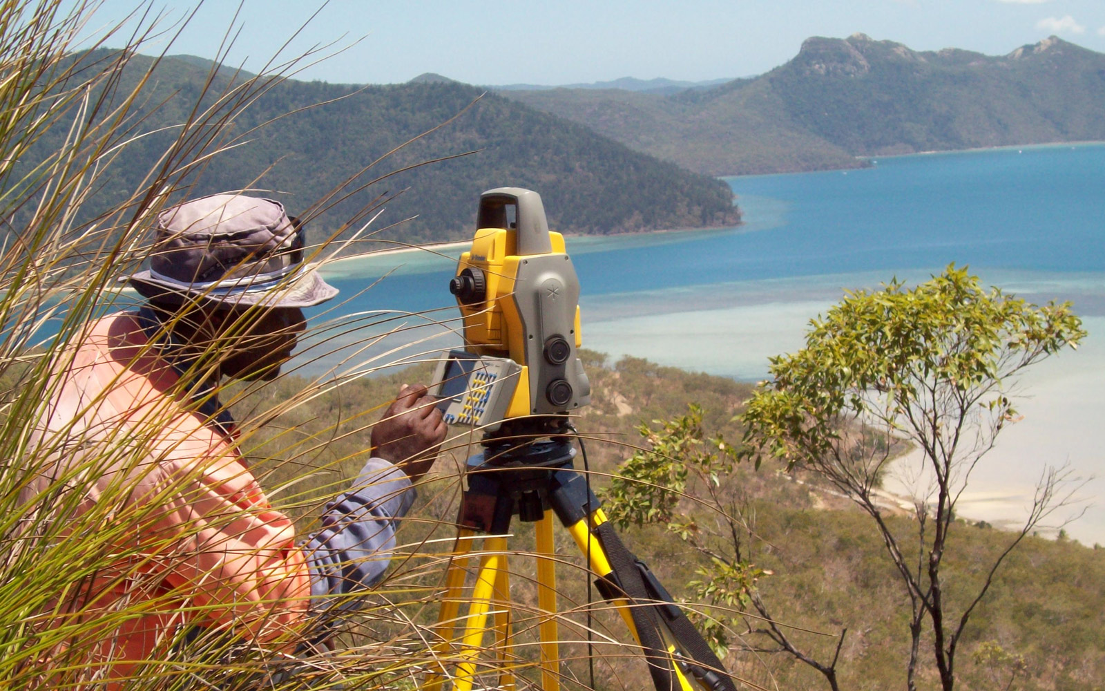
The industry is evolving and progressing through rapidly changing technological advancements, which means surveyors must keep pace with these innovations.
While traditional land surveying skills remain essential and in-demand, the field of surveying is increasingly becoming more technologically orientated. In the future, surveying will not just be overseen by a team of technicians, but also data analysts, and technology experts.
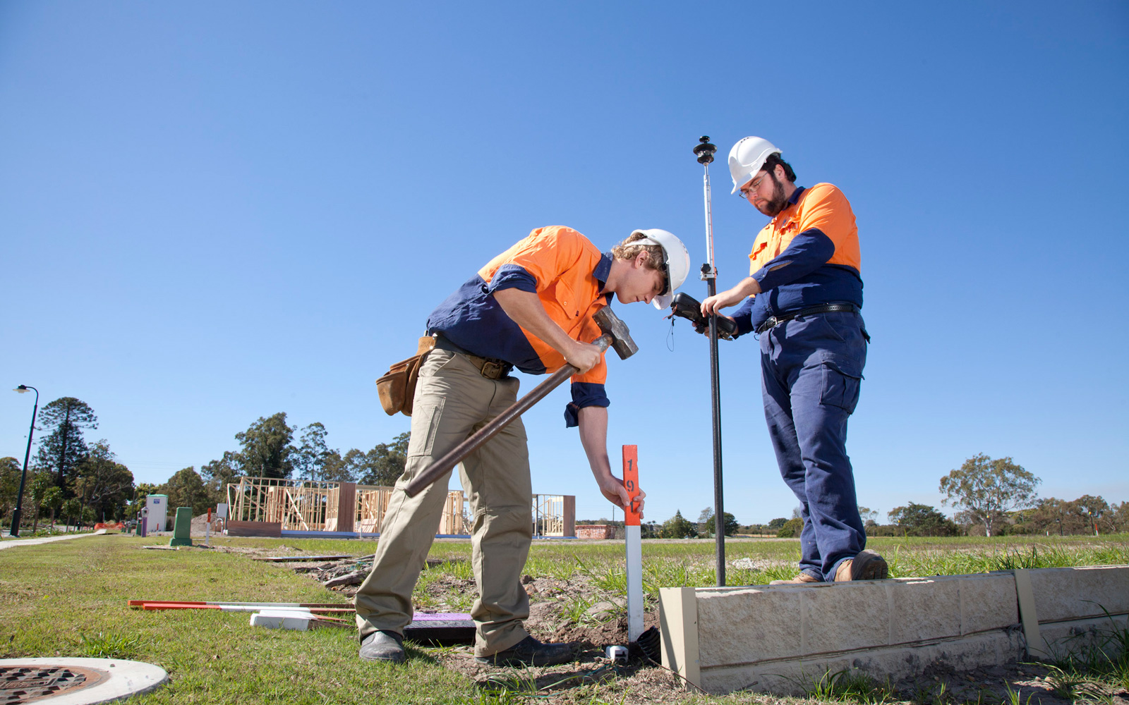
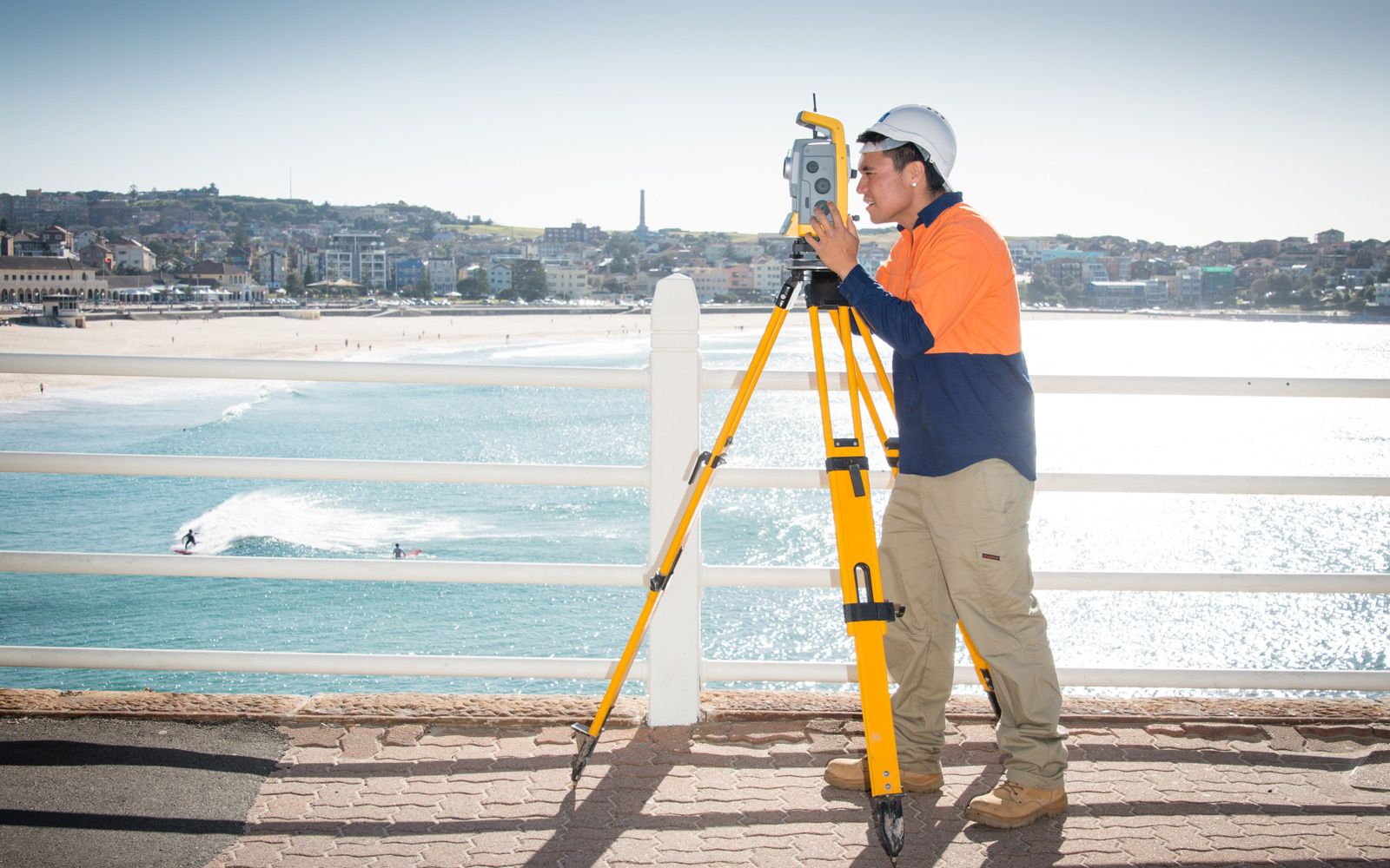
Every day as a surveyor is vastly different; whilst the diversity of projects and locations keeps the work fresh and exciting. Whether conducting a boundary survey in rural areas or working on infrastructure projects, there is always something new to learn.
Surveyors are often the first people on any construction site to accurately measure and map the land. Their initial measurements are able to inform architects and engineers to understand the environment and make the most of the unique landscape when designing structures.
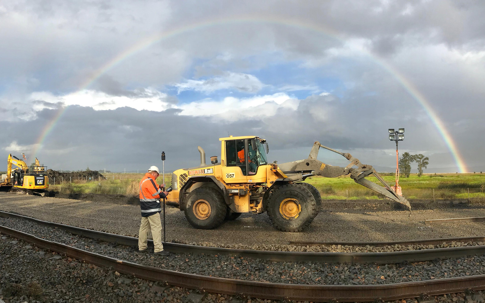
Surveyors get to enjoy outdoor adventures and problem-solving, however, when working in adverse weather conditions and remote locations the job is often challenging and unpredictable.
William John Wills of The Burke and Wills expedition which was the first European expedition to cross Australia from Melbourne to the Gulf of Carpentaria. Their route across the continent prompted the discovery of farming land enabling further European settlement in Australia.
You carry a *plumb-bob.
(*A plumb-bob, otherwise known as a plumb-bob level, or plummet, is the forerunner to the spirit level and is used to find a vertical line in the ground known as the ‘plumb’ which captures a vertical data point. Pencil-shaped, the plumb-bob is a pointed weight suspended from a string and dates back to the ancient Egyptians).
Mount Everest is named after British surveyor, Sir George Everest.
Innovative survey technology such as Global Navigation Satellite Systems (GNSS), laser scanners, drones, automation, and augmented reality. These types of technology advancements are constantly improving the surveying industry as well as surveyors’ capabilities, accuracy, and efficiency.


